
Consortium unveils greenhouse gas monitoring constellation Carbon Mapper
By Debra Werner
SAN FRANCISCO – A consortium led by the State of California, NASA Jet Propulsion Laboratory and Planet announced plans April 15 for a constellation of hyperspectral satellites to pinpoint, quantify and track point sources of methane and carbon dioxide.
The constellation is one element of Carbon Mapper, a public-private partnership aimed at providing information to help limit greenhouse gas emissions.
California government agencies including the state’s Air Resources Board have been laying the groundwork for Carbon Mapper since 2016 when then-Gov. Jerry Brown reacted to Trump Administration threat to NASA climate research by saying, “California will launch its own damn satellites.”
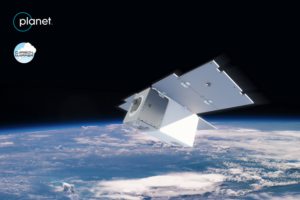
Partners, including the University of Arizona, Arizona State University, the High Tide Foundation and the non-profit RMI, are supporting the campaign to pair hyperspectral sensors developed at JPL with satellites roughly the size of Planet SkySats.
“These home-grown satellites are a game-changer,” California Gov. Gavin Newsom said in a statement. “They provide California with a powerful, state-of-the-art tool to help us slash emissions of the super-pollutant methane – within our own borders and around the world. That’s exactly the kind of dynamic, forward-thinking solution we need now to address the existential crisis of climate change.”
The first two Carbon Mapper satellites scheduled to launch in 2023 are designed to detect 80 percent of global methane sources as well as the largest carbon dioxide emitters. A larger constellation to follow in 2025 will begin providing daily observations of greenhouse gas sources, said Shanti Rao, JPL Carbon Mapper constellation architect.
Carbon Mapper also is designed to heighten public awareness and understanding of greenhouse gas emissions. Data captured by the satellites plus airborne sensors surveying major oil and gas fields will be shared through a public portal being developed by the California Air Resources Board.
The ultimate size of the Carbon Mapper constellation has not yet been determined.
Carbon Mapper is the latest addition to a virtual constellation of satellites seeking to pinpoint, measure and monitor greenhouse gas emissions. That constellation includes Europe’s Copernicus Sentinel-5 satellite, NASA’s Orbiting Carbon Observatory and GHGSat of Canada’s constellation of methane-monitoring spacecraft.
Carbon Mapper’s visible and infrared imaging spectrometers are designed to provide data with a resolution of 30 meters per pixel, according to a paper presented in December at the virtual American Geophysical Union conference.
The California-based High Tide Foundation led the campaign to find philanthropic backing for the work. Contributors include the Grantham Foundation for Protection of the Environment, Bloomberg Philanthropies, Zegar Family Foundation and the University of Arizona.
April 15, 2021 at 10:22PM
via SpaceNews read more...


Post a Comment